
Thank you for supporting this site ❤️
Make a donation
Make a donation
La Flor topographic map
Click on the map to display elevation.
Thank you for supporting this site ❤️
Make a donation
Make a donation
About this map
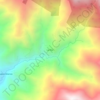
Name: La Flor topographic map, elevation, terrain.
Location: La Flor, Colasay, Jaén, Cajamarca, Perú (-5.75396 -79.00862 -5.71396 -78.96862)
Average elevation: 1,997 m
Minimum elevation: 1,347 m
Maximum elevation: 2,706 m
Thank you for supporting this site ❤️
Make a donation
Make a donation
Other topographic maps
Click on a map to view its topography, its elevation and its terrain.