
Thank you for supporting this site ❤️
Make a donation
Make a donation
Prestfjall topographic map
Click on the map to display elevation.
Thank you for supporting this site ❤️
Make a donation
Make a donation
About this map
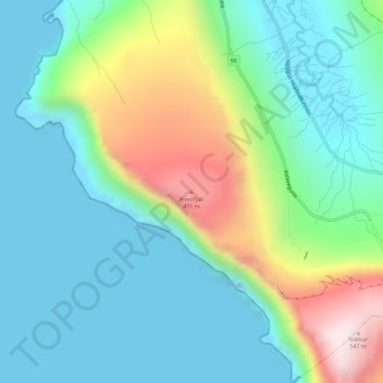
Name: Prestfjall topographic map, elevation, terrain.
Location: Prestfjall, Hvalba, Suðuroyar sýsla, 850, Færøerne (61.57402 -6.95146 61.57412 -6.95136)
Average elevation: 148 m
Minimum elevation: -42 m
Maximum elevation: 544 m
Thank you for supporting this site ❤️
Make a donation
Make a donation