
Thank you for supporting this site ❤️
Make a donation
Make a donation
Tunnafjall topographic map
Click on the map to display elevation.
Thank you for supporting this site ❤️
Make a donation
Make a donation
About this map
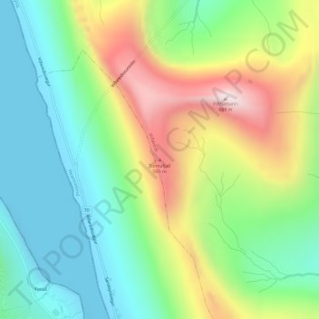
Name: Tunnafjall topographic map, elevation, terrain.
Location: Tunnafjall, Viðareiði, Norðoya sýsla, 750, Færøerne (62.31407 -6.51456 62.31417 -6.51446)
Average elevation: 247 m
Minimum elevation: -7 m
Maximum elevation: 689 m
Thank you for supporting this site ❤️
Make a donation
Make a donation