
Thank you for supporting this site ❤️
Make a donation
Make a donation
Moskursfjall topographic map
Click on the map to display elevation.
Thank you for supporting this site ❤️
Make a donation
Make a donation
About this map
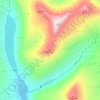
Name: Moskursfjall topographic map, elevation, terrain.
Location: Moskursfjall, Vestmanna, Streymoyar sýsla, 350, Færøerne (62.18208 -7.13489 62.18218 -7.13479)
Average elevation: 410 m
Minimum elevation: 217 m
Maximum elevation: 701 m
Thank you for supporting this site ❤️
Make a donation
Make a donation