
San Blas topographic map
Interactive map
Click on the map to display elevation.
About this map
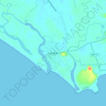
Name: San Blas topographic map, elevation, terrain.
Location: San Blas, Nayarit, 63774, México (21.50294 -105.32490 21.58294 -105.24490)
Average elevation: 5 m
Minimum elevation: -4 m
Maximum elevation: 72 m
Other topographic maps
Click on a map to view its topography, its elevation and its terrain.
Jalcocotán
Jalcocotán, San Blas, Nayarit, 63770, México
Average elevation: 534 m
Islas Marías
Islas Marías, San Blas, Nayarit, México
Average elevation: 14 m