
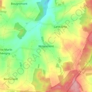
Wideumont topographic map
Interactive map
Click on the map to display elevation.
About this map
Name: Wideumont topographic map, elevation, terrain.
Average elevation: 498 m
Minimum elevation: 447 m
Maximum elevation: 558 m
Other topographic maps
Click on a map to view its topography, its elevation and its terrain.
Sainte-Marie-Chevigny
Belgique > Luxembourg > Neufchâteau > Saint-Marie-Chevigny
Sainte-Marie-Chevigny, Saint-Marie-Chevigny, Libramont-Chevigny, Neufchâteau, Luxembourg, Wallonie, Belgique
Average elevation: 497 m
Bernimont
Belgique > Luxembourg > Neufchâteau > Saint-Marie-Chevigny > Bernimont
Bernimont, Saint-Marie-Chevigny, Libramont-Chevigny, Neufchâteau, Luxembourg, Wallonie, Belgique
Average elevation: 499 m