
gmina Włodawa topographic map
Interactive map
Click on the map to display elevation.
About this map
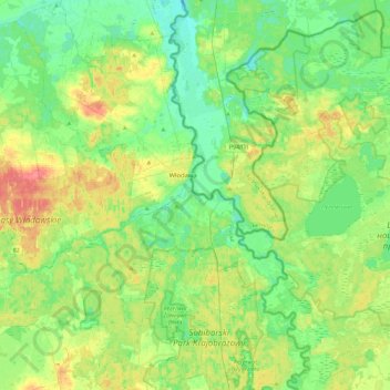
Name: gmina Włodawa topographic map, elevation, terrain.
Location: gmina Włodawa, Włodawa County, Lublin Voivodeship, Poland (51.38789 23.35489 51.67485 23.68641)
Average elevation: 166 m
Minimum elevation: 148 m
Maximum elevation: 200 m
Other topographic maps
Click on a map to view its topography, its elevation and its terrain.
Huta
Poland > Lublin Voivodeship > Włodawa County > Dubeczno
Huta, Dubeczno, gmina Hańsk, Włodawa County, Lublin Voivodeship, 22-235, Poland
Average elevation: 169 m