
Thank you for supporting this site ❤️
Make a donation
Make a donation
Langon topographic map
Click on the map to display elevation.
Thank you for supporting this site ❤️
Make a donation
Make a donation
About this map
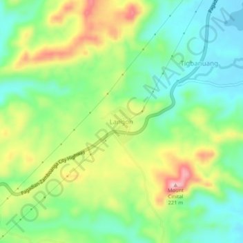
Name: Langon topographic map, elevation, terrain.
Location: Langon, Zamboanga Sibugay, Zamboanga Peninsula, Philippines (7.53961 122.38736 7.57961 122.42736)
Average elevation: 76 m
Minimum elevation: 0 m
Maximum elevation: 200 m
Thank you for supporting this site ❤️
Make a donation
Make a donation
Other topographic maps
Click on a map to view its topography, its elevation and its terrain.