
Thank you for supporting this site ❤️
Make a donation
Make a donation
Marlborough topographic map
Click on the map to display elevation.
Thank you for supporting this site ❤️
Make a donation
Make a donation
Marlborough
Marlborough has an oceanic climate somewhat influenced by its inland position and at 407 feet (124 m) elevation is more prone to frost than southern coastal areas. For example, in 1909 the town reported the equal lowest temperature in the UK at a station below 1,600 feet (500 m) for that year, with a temperature of −17.8 °C (0.0 °F) on 3 March.
Thank you for supporting this site ❤️
Make a donation
Make a donation
About this map
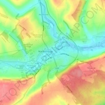
Name: Marlborough topographic map, elevation, terrain.
Location: Marlborough, Wiltshire, England, United Kingdom (51.40358 -1.76224 51.43758 -1.70455)
Average elevation: 163 m
Minimum elevation: 122 m
Maximum elevation: 207 m
Thank you for supporting this site ❤️
Make a donation
Make a donation