
Arborfield topographic map
Click on the map to display elevation.
About this map
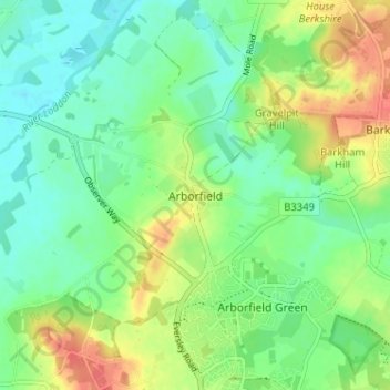
Name: Arborfield topographic map, elevation, terrain.
Average elevation: 57 m
Minimum elevation: 37 m
Maximum elevation: 90 m
Other topographic maps
Click on a map to view its topography, its elevation and its terrain.
Finchampstead Ridges
United Kingdom > England > Borough of Wokingham > Finchampstead
Average elevation: 72 m