
Thank you for supporting this site ❤️
Make a donation
Make a donation
Lusaran topographic map
Click on the map to display elevation.
Thank you for supporting this site ❤️
Make a donation
Make a donation
About this map
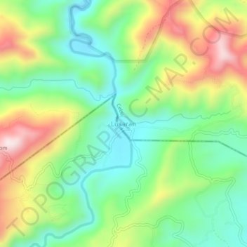
Name: Lusaran topographic map, elevation, terrain.
Location: Lusaran, Cebu, Central Visayas, Philippines (10.47096 123.87059 10.51096 123.91059)
Average elevation: 323 m
Minimum elevation: 124 m
Maximum elevation: 647 m
Thank you for supporting this site ❤️
Make a donation
Make a donation
Other topographic maps
Click on a map to view its topography, its elevation and its terrain.