
Rijsoord topographic map
Interactive map
Click on the map to display elevation.
About this map
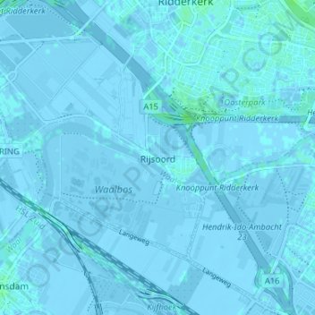
Name: Rijsoord topographic map, elevation, terrain.
Location: Rijsoord, Südholland, Niederlande, 2988AK, Niederlande (51.83152 4.57425 51.87152 4.61425)
Average elevation: 0 m
Minimum elevation: -6 m
Maximum elevation: 5 m