
Thank you for supporting this site ❤️
Make a donation
Make a donation
Shawville topographic map
Click on the map to display elevation.
Thank you for supporting this site ❤️
Make a donation
Make a donation
About this map
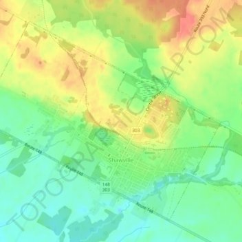
Name: Shawville topographic map, elevation, terrain.
Location: Shawville, Pontiac, Outaouais, Quebec, J0X 2Y0, Canada (45.59538 -76.51885 45.62229 -76.47223)
Average elevation: 171 m
Minimum elevation: 146 m
Maximum elevation: 199 m
Thank you for supporting this site ❤️
Make a donation
Make a donation
Other topographic maps
Click on a map to view its topography, its elevation and its terrain.