
Dreetz topographic map
Interactive map
Click on the map to display elevation.
About this map
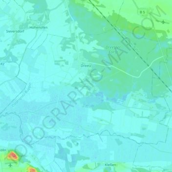
Name: Dreetz topographic map, elevation, terrain.
Average elevation: 31 m
Minimum elevation: 24 m
Maximum elevation: 99 m
Other topographic maps
Click on a map to view its topography, its elevation and its terrain.
Klosterheide
Duitsland > Brandenburg > Ostprignitz-Ruppin > Lindow (Mark)
Klosterheide, Lindow (Mark), Ostprignitz-Ruppin, Brandenburg, Duitsland
Average elevation: 50 m