
Zona Industrial de Maturín topographic map
Interactive map
Click on the map to display elevation.
About this map
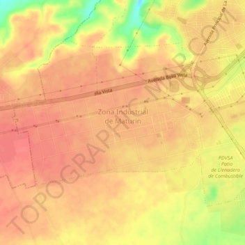
Name: Zona Industrial de Maturín topographic map, elevation, terrain.
Average elevation: 103 m
Minimum elevation: 59 m
Maximum elevation: 117 m
Other topographic maps
Click on a map to view its topography, its elevation and its terrain.
Maturín
Venezuela > Estado Monagas > Municipio Maturín > Maturín
Maturín, Parroquia San Simón, Municipio Maturín, Estado Monagas, 6201, Venezuela
Average elevation: 56 m