Lac du Distroit topographic map
Interactive map
Click on the map to display elevation.
About this map
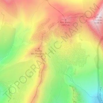
Name: Lac du Distroit topographic map, elevation, terrain.
Average elevation: 2,565 m
Minimum elevation: 2,074 m
Maximum elevation: 3,022 m

Click on the map to display elevation.
Name: Lac du Distroit topographic map, elevation, terrain.
Average elevation: 2,565 m
Minimum elevation: 2,074 m
Maximum elevation: 3,022 m