
Thank you for supporting this site ❤️
Make a donation
Make a donation
01000 topographic map
Click on the map to display elevation.
Thank you for supporting this site ❤️
Make a donation
Make a donation
About this map
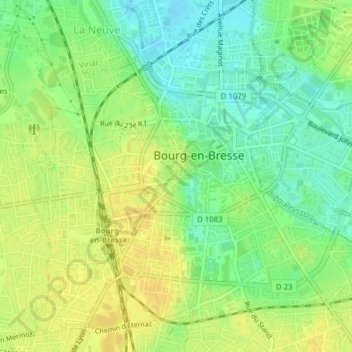
Name: 01000 topographic map, elevation, terrain.
Average elevation: 236 m
Minimum elevation: 222 m
Maximum elevation: 246 m
Thank you for supporting this site ❤️
Make a donation
Make a donation
Other topographic maps
Click on a map to view its topography, its elevation and its terrain.
Carronnières de Challes
France > Auvergne-Rhône-Alpes > Ain > Bourg-en-Bresse
Average elevation: 241 m