
Thank you for supporting this site ❤️
Make a donation
Make a donation
La Perala topographic map
Click on the map to display elevation.
Thank you for supporting this site ❤️
Make a donation
Make a donation
About this map
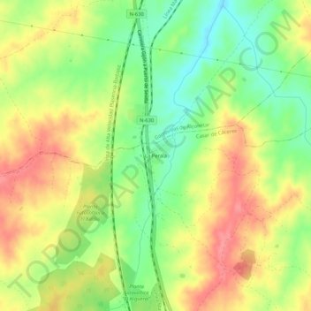
Name: La Perala topographic map, elevation, terrain.
Location: La Perala, Casar de Cáceres, Cáceres, Extremadura, España (39.60332 -6.49925 39.64332 -6.45925)
Average elevation: 363 m
Minimum elevation: 323 m
Maximum elevation: 402 m
Thank you for supporting this site ❤️
Make a donation
Make a donation