
Thank you for supporting this site ❤️
Make a donation
Make a donation
Fang topographic map
Click on the map to display elevation.
Thank you for supporting this site ❤️
Make a donation
Make a donation
About this map
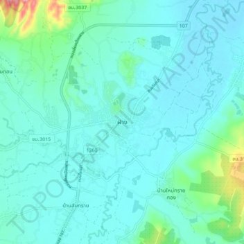
Name: Fang topographic map, elevation, terrain.
Location: Fang, San Sai, Chiang Mai Province, 50110, Thailand (19.88042 99.17555 19.96042 99.25555)
Average elevation: 480 m
Minimum elevation: 457 m
Maximum elevation: 614 m
Thank you for supporting this site ❤️
Make a donation
Make a donation
Other topographic maps
Click on a map to view its topography, its elevation and its terrain.