
Thank you for supporting this site ❤️
Make a donation
Make a donation
Baranda topographic map
Click on the map to display elevation.
Thank you for supporting this site ❤️
Make a donation
Make a donation
About this map
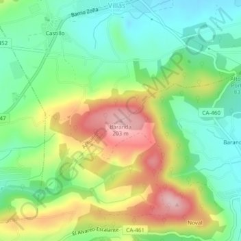
Name: Baranda topographic map, elevation, terrain.
Location: Baranda, Escalante, Cantabria, 39193, España (43.44709 -3.54318 43.44719 -3.54308)
Average elevation: 82 m
Minimum elevation: 8 m
Maximum elevation: 197 m
Thank you for supporting this site ❤️
Make a donation
Make a donation