
Marlborough topographic map
Interactive map
Click on the map to display elevation.
About this map
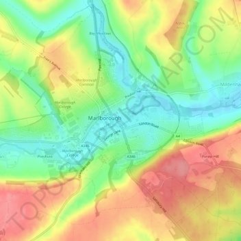
Name: Marlborough topographic map, elevation, terrain.
Location: Marlborough, Wiltshire, England, Vereinigtes Königreich (51.40358 -1.76224 51.43758 -1.70455)
Average elevation: 163 m
Minimum elevation: 122 m
Maximum elevation: 206 m