
Thank you for supporting this site ❤️
Make a donation
Make a donation
Caldwell topographic map
Click on the map to display elevation.
Thank you for supporting this site ❤️
Make a donation
Make a donation
About this map
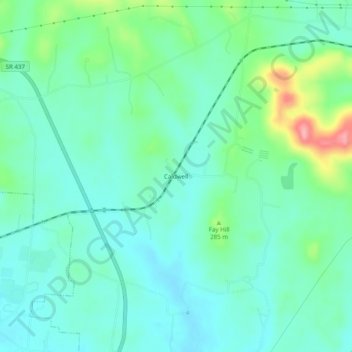
Name: Caldwell topographic map, elevation, terrain.
Location: Caldwell, Bedford County, Tennessee, United States (35.48367 -86.40212 35.52367 -86.36212)
Average elevation: 263 m
Minimum elevation: 234 m
Maximum elevation: 354 m
Thank you for supporting this site ❤️
Make a donation
Make a donation
Other topographic maps
Click on a map to view its topography, its elevation and its terrain.