
Stein topographic map
Interactive map
Click on the map to display elevation.
About this map
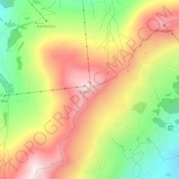
Name: Stein topographic map, elevation, terrain.
Location: Stein, Lumnezia, Surselva, Grauwbunderland, 7134, Zwitserland (46.72588 9.12715 46.72598 9.12725)
Average elevation: 1,872 m
Minimum elevation: 1,546 m
Maximum elevation: 2,184 m
Other topographic maps
Click on a map to view its topography, its elevation and its terrain.
Lumnezia
Zwitserland > Grauwbunderland > Lumnezia
Lumnezia, Surselva, Grauwbunderland, Zwitserland
Average elevation: 1,900 m