
Make a donation
Ferrum topographic map
Click on the map to display elevation.
Make a donation
About this map
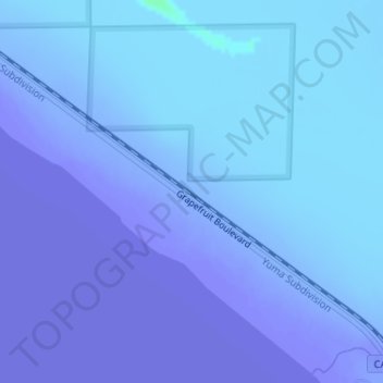
Name: Ferrum topographic map, elevation, terrain.
Location: Ferrum, California, United States (33.44864 -115.87083 33.46864 -115.85083)
Average elevation: -48 m
Minimum elevation: -71 m
Maximum elevation: 4 m
Make a donation
Other topographic maps
Click on a map to view its topography, its elevation and its terrain.
San Francisco
San Francisco is characterized by its striking and varied topography, making it one of the most distinctive cities in the United States. The landscape features a mix of rolling hills and steep inclines, with the highest elevation reaching approximately 922 feet at Twin Peaks. The average elevation across the…
Average elevation: 65 m
Los Angeles
United States > California > Los Angeles County
Los Angeles is characterized by a diverse and dynamic topography. The city is predominantly situated in a basin bordered by mountain ranges, including the Santa Monica Mountains to the north and the San Gabriel Mountains to the east, with elevations reaching up to about 10,000 feet (3,048 meters) in certain…
Average elevation: 241 m
San Diego
United States > California > San Diego County
San Diego is characterized by a diverse topography that features coastal plains, rolling hills, and rugged mountain ranges. The city is situated along the Pacific Ocean, where it boasts an extensive shoreline with sandy beaches and tidal zones. As you move inland, the landscape transitions from the flat…
Average elevation: 125 m
Make a donation
Oakland
United States > California > Alameda County
Oakland features a diverse topography shaped by its location along the eastern shore of San Francisco Bay and the presence of the nearby coastal hills. The city sits on a flat coastal plain that gradually ascends toward the Oakland Hills to the east, where elevations can exceed 1,700 feet. The highest point…
Average elevation: 51 m
Escondido
United States > California > San Diego County
Escondido has a borderline semi-arid climate (Köppen: Bsh) and hot-summer Mediterranean climate (Köppen: Csa) with hot summers and cool wet winters. Owing to its inland setting it is considerably warmer than coastal cities like San Diego, Carlsbad or Oceanside during the summertime, and cooler in the winter.…
Average elevation: 273 m
Make a donation
Palm Springs
United States > California > Riverside County
One possible origin of palm in the place name comes from early Spanish explorers who referred to the area as La Palma de la Mano de Dios or "The Palm of God's hand". The earliest use of the name "Palm Springs" is from United States Topographical Engineers who used the term in 1853 maps. According to William…
Average elevation: 859 m
Santa Catalina Island
United States > California > Los Angeles County > Avalon
Catalina is primarily composed of two distinct rock units: Catalina Schist from the Early Cretaceous (95 to 109 million years ago), and Miocene volcanic and intrusive igneous rocks. The island is rich in quartz, to the extent that some beaches on the seaward side have silvery-grey sand. These formations…
Average elevation: 60 m
Lake Tahoe
United States > California > Placer County
Lake Tahoe is renowned for its dramatic topography, characterized by rugged mountain ranges and deep, crystal-clear waters. Nestled in the Sierra Nevada, the lake itself lies at an elevation of approximately 6,225 feet (1,897 meters) and spans about 22 miles (35 kilometers) in length and 12 miles (19…
Average elevation: 2,077 m
Make a donation
Los Angeles
United States > California > Los Angeles County
Los Angeles is characterized by a diverse and dynamic topography. The city is predominantly situated in a basin bordered by mountain ranges, including the Santa Monica Mountains to the north and the San Gabriel Mountains to the east, with elevations reaching up to about 10,000 feet (3,048 meters) in certain…
Average elevation: 241 m
Pasadena
United States > California > Los Angeles County
An obscure portion of the Angeles Crest Highway (SR 2) in the San Gabriel Mountains cuts through Pasadena near the Angeles Crest Ranger Station. This 2-mile (3.2 km) stretch of highway in the Angeles National Forest is north of La Cañada Flintridge and west of Mount Wilson and is approximately 3,000 feet (910…
Average elevation: 548 m
Roseville
United States > California > Placer County
Roseville has a hot-summer Mediterranean climate that is characterized by cool, wet, usually snowless winters and hot, dry summers (Köppen Csa). The wet season is generally October through April. Because Roseville is east of Sacramento and at a higher elevation, it receives slightly more rainfall. Average…
Average elevation: 67 m
Make a donation
Berkeley
United States > California > Alameda County
Berkeley, located on the eastern shore of San Francisco Bay, features a diverse topography characterized by rolling hills and steep slopes. The city sits at an elevation that ranges from sea level along the bay to about 1,300 feet (396 meters) in the Berkeley Hills. This hilly landscape provides stunning views…
Average elevation: 109 m
South Lake Tahoe
United States > California > El Dorado County
According to the United States Census Bureau, the city has a total area of 16.6 square miles (43 km2), of which 10.2 square miles (26 km2) is land and 6.4 square miles (17 km2), or 38.80%, is water. Its elevation is about 6,237 feet (1,901 m) above sea level.
Average elevation: 1,979 m
San Diego
United States > California > San Diego County
The climate in San Diego, like most of Southern California, often varies significantly over short geographical distances, resulting in microclimates. In San Diego, this is mostly because of the city's topography (the Bay, and the numerous hills, mountains, and canyons). Frequently, particularly during the "May…
Average elevation: 125 m
Make a donation
Santa Clarita
United States > California > Los Angeles County
The official elevation of the city is 1,207 feet (368 m), the elevation of the historic Newhall Airport which was northwest of Via Princessa and Railroad Avenue from the 1930s through the 1950s. Elevation varies substantially throughout the city. The lowest point in Santa Clarita is near the junction of CA-126…
Average elevation: 514 m
Sonoma County
Sonoma County, as is often the case with coastal counties in California, has a great degree of climatic variation and numerous, often very different, microclimates. Key determining factors for local climate are proximity to the ocean, elevation, and the presence and elevation of hills or mountains to the east…
Average elevation: 210 m
Make a donation
Make a donation
Angeles National Forest
United States > California > Los Angeles County
The Angeles National Forest manages the habitats, flora and fauna ecosystems, and watersheds. Some of the rivers with watersheds within its boundaries provide valuable non-groundwater recharge water for Southern California. The existing protected and restored native vegetation absorb and slow surface runoff of…
Average elevation: 782 m
Yosemite National Park
The geology of the Yosemite area is characterized by granite rocks and remnants of older rock. About 10 million years ago, the Sierra Nevada was uplifted and tilted to form its unique slopes, which increased the steepness of stream and river beds, resulting in the formation of deep, narrow canyons. About one…
Average elevation: 2,337 m
Joshua Tree National Park
Joshua Tree National Park is an American national park in southeastern California, east of San Bernardino and Los Angeles and north of Palm Springs. It is named after the Joshua trees (Yucca brevifolia) native to the Mojave Desert. Originally declared a national monument in 1936, Joshua Tree was redesignated…
Average elevation: 639 m
La Mesa
United States > California > San Diego County
The climate in the San Diego area, like much of California, often varies significantly over short geographical distances, resulting in micro-climates. In San Diego's case, this is mainly due to the city's topography (the Bay, and the numerous hills, mountains, and canyons). Frequently, particularly during the…
Average elevation: 171 m
Make a donation
Death Valley
Death Valley's Badwater Basin is the point of lowest elevation in North America, at 282 feet (86 m) below sea level. It is 84.6 miles (136.2 km) east-southeast of Mount Whitney, the highest point in the contiguous United States, with an elevation of 14,505 feet (4,421 m). On the afternoon of July 10, 1913, the…
Average elevation: 1,085 m
Coachella
United States > California > Riverside County
The elevation is 68 feet (21 m) below sea level, as the eastern half of the Coachella Valley is below sea level. The saltwater lake, Salton Sea, 10 miles (16 km) south of Coachella, is 228 feet (69 m) below sea level.
Average elevation: 2 m
Truckee
United States > California > Nevada County
Truckee is characterized by its dramatic topography set in the Sierra Nevada mountain range. The town sits at an elevation of approximately 5,817 feet (1,774 meters), surrounded by a stunning landscape of rugged mountains, rolling hills, and expansive forested areas. Prominent features include Donner Pass,…
Average elevation: 1,918 m
Make a donation
Make a donation
Bakersfield
United States > California > Kern County
Most of Bakersfield's major streets are six-lane divided roads with bike lanes, with almost every street in the city having proper lane signage for bicycle traffic. Bikes are a popular method of transportation in Bakersfield, due to the city's relatively flat topography and grid-like street system. Newer…
Average elevation: 157 m
Oceanside
United States > California > San Diego County
Oceanside features a diverse topography characterized by its coastal setting and gentle inland elevations. The city is predominantly flat, with its elevation averaging around 66 feet (20 meters) above sea level, allowing for expansive views of the Pacific Ocean along its roughly 3.5 miles of coastline. Inland,…
Average elevation: 32 m
Make a donation
Monterey
United States > California > Monterey County
During winter, snow occasionally falls in the higher elevations of the Santa Lucia Mountains and Gabilan Mountains that overlook Monterey, but snow in Monterey itself is extremely rare. A few unusual events in January 1962, February 1976, and December 1997 brought a light coating of snow to Monterey. In March…
Average elevation: 50 m
Make a donation
Encinitas
United States > California > San Diego County
Encinitas lies on rugged coastal terrace. The city is bisected by a low-lying coastal ridge that separates New and Old Encinitas. In the north of the city, the coast rises in elevation and the land is raised up in the form of many coastal bluffs. These cliffs are subject to collapsing on the narrow beach. The…
Average elevation: 32 m
Santa Barbara
United States > California > Santa Barbara County
Annual rainfall totals are highly variable and in exceptional years like 1940–1941 and 1997–1998 over 40 inches (1.0 m) of rain have fallen in a year, but in dry seasons less than 6 inches (150 mm) is not unheard of. Snow sometimes covers higher elevations of the Santa Ynez Mountains but is extremely rare…
Average elevation: 119 m
San Jose
United States > California > Santa Clara County
San Jose, located in Santa Clara County, California, features a diverse topography characterized by a mix of low-lying plains and rolling hills. The city sits at an average elevation of approximately 82 feet (25 meters) above sea level, with the surrounding terrain including the foothills of the Santa Cruz…
Average elevation: 265 m
Make a donation
Make a donation
Redding
United States > California > Shasta County
The elevation in Redding is 495 feet (151 meters) on average, whereas anywhere to the north, east, or west of downtown ranges between 550 feet (170 m) and 800 feet (240 m) feet. Southern portions range between 400 feet (120 m) and 500 feet (150 m).
Average elevation: 240 m
Eureka
United States > California > Humboldt County
Eureka, located along Humboldt Bay in Northern California, has a diverse and varied topography. The city itself is situated at relatively low elevations, with the bay’s narrow point serving as a key feature in the landscape. Its average elevation is around 50 feet (15 meters), and the terrain gently rises…
Average elevation: 16 m
Make a donation
Humboldt County
The coastal zone of the county experiences very wet, cool winters and dry, mild foggy summers. In the winter, temperatures range from highs of 40–59 °F (4–15 °C) to lows of 32–49 °F (0–9 °C). Coastal summers are cool to mild, with average highs of 60–69 °F (16–21 °C) and frequent fogs.…
Average elevation: 540 m
Death Valley National Park
There are two major valleys in the park, Death Valley and Panamint Valley. Both of these valleys were formed within the last few million years and both are bounded by north–south-trending mountain ranges. These and adjacent valleys follow the general trend of Basin and Range topography with one modification:…
Average elevation: 1,171 m
Amador County
Amador County ranges in elevation from approximately 250 feet (76 m) in the western portion of the county to over 9,000 feet (2,700 m) in the eastern portion of the county, the tallest point being Thunder Mountain. The county is bordered on the north by the Cosumnes River and El Dorado County and on the south…
Average elevation: 896 m
Make a donation
San Rafael
United States > California > Marin County
San Rafael has a wide diversity of natural habitats from forests at the higher elevations to marshland and estuarine settings. Its marshes are home to the endangered species salt marsh harvest mouse. There are also riparian areas including the San Rafael Creek and Miller Creek corridors.
Average elevation: 78 m
Yosemite National Park
The geology of the Yosemite area is characterized by granite rocks and remnants of older rock. About 10 million years ago, the Sierra Nevada was uplifted and tilted to form its unique slopes, which increased the steepness of stream and river beds, resulting in the formation of deep, narrow canyons. About one…
Average elevation: 2,337 m
Make a donation
La Cañada Flintridge
United States > California > Los Angeles County
La Cañada Flintridge varies in elevation from about 970 feet (300 m) just below Devil's Gate Dam in the Arroyo Seco to about 2,400 feet (730 m) at the highest neighborhood, along the mountain front east of Pickens Canyon, at the upper end of Ocean View Blvd. The city limits extend into the San Gabriel…
Average elevation: 503 m
Santa Cruz Mountains
United States > California > Santa Clara County
The Santa Cruz Mountains are a region of great biological diversity, encompassing cool, moist coastal ecosystems as well as warm, dry chaparral. Much of the area in the Santa Cruz mountains is considered temperate rainforest. In valleys and moist ocean-facing slopes some of the southernmost coast redwoods…
Average elevation: 230 m
Kings Canyon National Park
United States > California > Fresno County
Kings Canyon is characterized by some of the steepest vertical relief in North America, with numerous peaks over 14,000 feet (4,300 m) on the Sierra Crest along the park's eastern border, falling to 4,500 feet (1,400 m) in the valley floor of Cedar Grove just ten miles (16 km) to the west. The Sierran crest…
Average elevation: 2,591 m
Make a donation
Chico
United States > California > Butte County
An altitude record for unmanned gas balloons was set in Chico in October 1972 (51.8 km or 32.2 mi). The record was broken on May 23, 2002.
Average elevation: 95 m
Bishop
United States > California > Inyo County
Bishop (formerly Bishop Creek) is a city in California, United States. It is the largest populated place and only incorporated city in Inyo County. Bishop is located near the northern end of the Owens Valley, at an elevation of 4,150 feet (1,260 m). The city was named after Bishop Creek, flowing out of the…
Average elevation: 1,265 m
San Diego County
San Diego County has a varied topography. On its western side is more than 70 miles (113 km) of coastline. Most of San Diego between the coast and the Laguna Mountains consists of hills, mesas, and small canyons. Snow-capped (in winter) mountains rise to the east, with the Sonoran Desert farther to the east.…
Average elevation: 544 m
Santa Barbara County
The principal mountain ranges of the county are the Santa Ynez Mountains in the south, and the San Rafael Mountains and Sierra Madre Mountains in the interior and northeast. Most of the mountainous area is within the Los Padres National Forest, and includes two wilderness areas: the San Rafael Wilderness and…
Average elevation: 243 m
Make a donation
El Dorado Hills
United States > California > El Dorado County > Cameron Park
El Dorado Hills (EDH), as defined by the 2010 census-designated place (CDP), is at the western border of El Dorado County, between the City of Folsom and the unincorporated community of Cameron Park. The northern limits of the CDP are Folsom Lake and the South Fork of the American River, where river rafters…
Average elevation: 254 m
Pacific Palisades
United States > California > Los Angeles County > Los Angeles
Pacific Palisades was formally founded in 1921 by a Methodist organization, and in the years that followed became a refuge for Jewish artists and intellectuals fleeing the Holocaust. The Palisades would later be sought after by celebrities and other high-profile individuals seeking privacy. It is known for its…
Average elevation: 196 m
Redwood National Park
United States > California > Del Norte County
Redwoods prefer sheltered slopes, and they thrive on moist flat ground along rivers below 1,000 feet (300 m) in elevation. Coastal fog provides about 40 percent of their annual water intake. Redwoods have existed along the coast of northern California for at least 20 million years and are related to tree…
Average elevation: 367 m
Make a donation
Walnut Creek
United States > California > Contra Costa County
Walnut Creek's warm summer Mediterranean climate (Köppen climate classification Csb) is typical of California's interior valleys. In summer, high pressure results in almost unbroken sunshine and virtually no precipitation. Days start out cool but quickly warm up, with high temperatures normally in the 80s…
Average elevation: 119 m
Newport Beach
United States > California > Orange County
Newport Beach, located in Orange County, California, features a dynamic and varied topography shaped by its coastal position and surrounding hills. The city spans from sea level along its beaches to elevations of over 1,100 feet (335 meters) in the nearby San Joaquin Hills. These hills, particularly noticeable…
Average elevation: 14 m
Lone Pine
United States > California > Inyo County
Lone Pine is a census-designated place (CDP) in Inyo County, California, United States. Lone Pine is located 16 mi (26 km) south-southeast of Independence, at an elevation of 3,727 ft (1,136 m). The population was 2,035 at the 2010 census, up from 1,655 at the 2000 census. The town is located in the Owens…
Average elevation: 1,298 m
Make a donation
Long Beach
United States > California > Los Angeles County
Willow Springs Park was founded as a part of the Willow Springs Wetlands Restoration Project which opened in October 2017. The project restored 11 acres of a 48-acre degraded oil well site into wetlands. These highlight the pivotal role the ecosystem played in the City of Long Beach’s establishment in the…
Average elevation: 12 m
Camarillo
United States > California > Ventura County
In the mid-1950s, the Ventura Freeway was completed from Los Angeles to points north, making it an easy one-hour trip to Camarillo. The Old Town was bisect by the Ventura Freeway. On the southern side of the freeway contains a strip of businesses, churches, schools, and parks. The freeway was originally…
Average elevation: 90 m
Santa Clara County
Santa Clara County features a diverse and varied topography characterized by both low-lying valleys and rugged mountainous regions. The county encompasses a significant portion of Silicon Valley, where flat, urbanized areas are interspersed with rolling hills and foothills that rise sharply in the Santa Cruz…
Average elevation: 323 m
Make a donation
San Diego County
San Diego County's topography is marked by its dramatic variety, ranging from coastal plains to mountainous regions. The county stretches along California's southern border, with a coastline that includes sandy beaches, cliffs, and bays, such as the iconic San Diego Bay. Inland, the terrain rises into the…
Average elevation: 544 m
Ventura County
Ventura County can be separated into two major parts, East County and West County, which are divided by the Conejo Grade. East County consists of all cities east of the Conejo Grade. Geographically East County is the end of the Santa Monica Mountains, in which the Conejo Valley is located, and where there is a…
Average elevation: 331 m
Make a donation
Death Valley
Death Valley's Badwater Basin is the point of lowest elevation in North America, at 282 feet (86 m) below sea level. It is 84.6 miles (136.2 km) east-southeast of Mount Whitney — the highest point in the contiguous United States, with an elevation of 14,505 feet (4,421 m). On the afternoon of July 10, 1913,…
Average elevation: 1,085 m
Joshua Tree National Park
Joshua Tree National Park is an American national park in southeastern California, east of San Bernardino and Los Angeles and north of Palm Springs. It is named after the Joshua trees (Yucca brevifolia) native to the Mojave Desert. Originally declared a national monument in 1936, Joshua Tree was redesignated…
Average elevation: 639 m
Fullerton
United States > California > Orange County
Fullerton is located at 33°52′48″N 117°55′43″W / 33.88000°N 117.92861°W / 33.88000; -117.92861 (33.879914, -117.928749). It is approximately 25 miles (40 km) southeast of downtown Los Angeles, and approximately 11 miles (18 km) north-northwest of Santa Ana, the county seat. The city has a…
Average elevation: 79 m
Make a donation
Inyo County
Mount Whitney, the highest peak in the contiguous United States, is on Inyo County's western border (with Tulare County). The Badwater Basin in Death Valley National Park, the lowest place in North America, is in eastern Inyo County. The difference between the two points is about 14,700 feet (4,500 m). They…
Average elevation: 1,473 m
Make a donation