
Make a donation
Songling topographic map
Click on the map to display elevation.
Make a donation
About this map
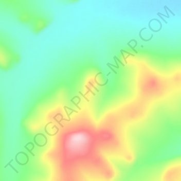
Name: Songling topographic map, elevation, terrain.
Location: Songling, Inner Mongolia, China (50.88166 124.90363 50.92166 124.94363)
Average elevation: 538 m
Minimum elevation: 464 m
Maximum elevation: 683 m
Make a donation
Other topographic maps
Click on a map to view its topography, its elevation and its terrain.
Xilinhot City
The elevation of Xilinhot is approximately 990 m (3,250 ft). The city is 610 and 620 km (380 and 390 mi) from Beijing and Hohhot (the capital of Inner Mongolia), respectively.
Average elevation: 1,162 m
Make a donation
Make a donation
Make a donation
Wuhai City
Wuhai is situated in western Inner Mongolia, in the upper reaches of the Yellow River, which flows through the city. The western bank of the river is Wuda District, while the eastern bank includes Haibowan District and Hainan District. The city borders Ordos City in Inner Mongolia to the east and north,…
Average elevation: 1,326 m
Make a donation
Make a donation
Make a donation
Hailar District
Hailar is located in close proximity to the Greater Xing'an Mountains, and has an elevation ranging from 603.0 to 776.6 m (1,978.3 to 2,547.9 ft). Of the city's 1,319.8 square kilometers, 28 square kilometers (or 2.12%) of the district is urban.
Average elevation: 670 m
Make a donation
Make a donation
Tongliao City
Tongliao's topography primarily consists of plains, though the northern stretch of the prefecture extends into the eastern foothills of the southern Greater Khingan. The central and eastern parts of the prefecture are marked by the plains of the Xiliao, Xinkai River (新开河), and Jiaolai rivers (教来河),…
Average elevation: 262 m
Make a donation
Make a donation
Dorbod Banner
China > Inner Mongolia > Ulanqab City
The banner is located along the northern foothills of the Yin Mountains, and has an average elevation of 1,400 metres (4,600 ft).[3] Most of the banner's area is grassland.[3]
Average elevation: 1,294 m
Make a donation