
Thank you for supporting this site ❤️
Make a donation
Make a donation
Gemeinde Tarrenz topographic map
Click on the map to display elevation.
Thank you for supporting this site ❤️
Make a donation
Make a donation
About this map
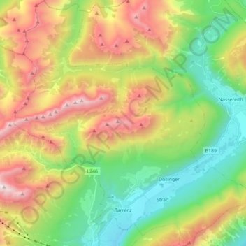
Name: Gemeinde Tarrenz topographic map, elevation, terrain.
Location: Gemeinde Tarrenz, Bezirk Imst, Tyrol, 6464, Autriche (47.24493 10.68493 47.36178 10.85787)
Average elevation: 1,570 m
Minimum elevation: 752 m
Maximum elevation: 2,712 m
Thank you for supporting this site ❤️
Make a donation
Make a donation