
Lissa topographic map
Interactive map
Click on the map to display elevation.
About this map
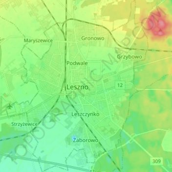
Name: Lissa topographic map, elevation, terrain.
Location: Lissa, Woiwodschaft Großpolen, Polen (51.80643 16.52380 51.88149 16.62425)
Average elevation: 98 m
Minimum elevation: 73 m
Maximum elevation: 145 m
Other topographic maps
Click on a map to view its topography, its elevation and its terrain.
Lissa
Polen > Woiwodschaft Großpolen > Lissa
Lissa, Woiwodschaft Großpolen, Polen
Average elevation: 97 m