
Costa da Caparica topographic map
Interactive map
Click on the map to display elevation.
About this map
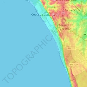
Name: Costa da Caparica topographic map, elevation, terrain.
Location: Costa da Caparica, Almada, Setúbal, Portugal (38.55032 -9.25276 38.66308 -9.18635)
Average elevation: 21 m
Minimum elevation: -1 m
Maximum elevation: 113 m
Other topographic maps
Click on a map to view its topography, its elevation and its terrain.