Geolocate
👉 Easily get elevation data in JSON, GeoTIFF and KML formats using Elevation API
Thank you for supporting this site ❤️
Make a donation

Pantai topographic map

Click on the map to display elevation.

👉 Easily get elevation data in JSON, GeoTIFF and KML formats using Elevation API
Thank you for supporting this site ❤️
Make a donation

About this map

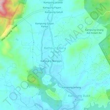
Name: Pantai topographic map, elevation, terrain.

Location: Pantai, Seremban, Negeri Sembilan, 71770, Malaysia (2.76152 101.97316 2.80152 102.01316)

Average elevation: 109 m

Minimum elevation: 64 m

Maximum elevation: 329 m

Other topographic maps

Click on a map to view its topography, its elevation and its terrain.

Jempol

Malaysia > Negeri Sembilan

Average elevation: 79 m

Jelebu

Malaysia > Negeri Sembilan

Amongst the seven districts of Negeri Sembilan, Jelebu is the most mountainous topographically as the Titiwangsa Mountains, the longest mountain range in Malaysia, transverses through the district. As a result, most of its terrain are dominated by forested undulating hills and mountain peaks. The Titiwangsa…

Average elevation: 307 m