
Cantón topographic map
Interactive map
Click on the map to display elevation.
About this map
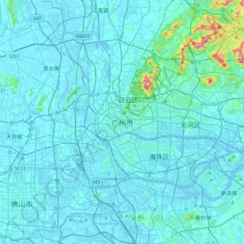
Name: Cantón topographic map, elevation, terrain.
Location: Cantón, 越秀区, Cantón, Guangdong, 510030, China (22.97020 113.09929 23.29020 113.41929)
Average elevation: 21 m
Minimum elevation: -15 m
Maximum elevation: 364 m
Other topographic maps
Click on a map to view its topography, its elevation and its terrain.