
Parc national de la Bénoué topographic map
Interactive map
Click on the map to display elevation.
About this map
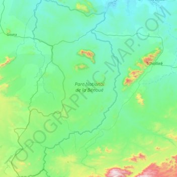
Name: Parc national de la Bénoué topographic map, elevation, terrain.
Location: Parc national de la Bénoué, Tcholliré, Mayo-Rey, NO, Cameroun (7.92631 13.56258 8.66683 14.02401)
Average elevation: 425 m
Minimum elevation: 215 m
Maximum elevation: 1,632 m