
Thank you for supporting this site ❤️
Make a donation
Make a donation
Costa Occidental topographic map
Click on the map to display elevation.
Thank you for supporting this site ❤️
Make a donation
Make a donation
About this map
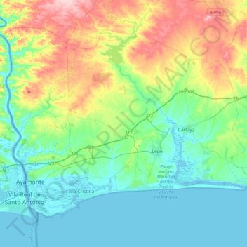
Name: Costa Occidental topographic map, elevation, terrain.
Location: Costa Occidental, Huelva, Andalucía, España (37.16619 -7.45112 37.41361 -7.05308)
Average elevation: 57 m
Minimum elevation: -2 m
Maximum elevation: 206 m
Thank you for supporting this site ❤️
Make a donation
Make a donation
Other topographic maps
Click on a map to view its topography, its elevation and its terrain.