
Ernakulam topographic map
Interactive map
Click on the map to display elevation.
About this map
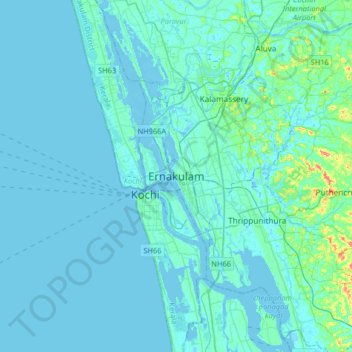
Name: Ernakulam topographic map, elevation, terrain.
Average elevation: 6 m
Minimum elevation: -5 m
Maximum elevation: 75 m
The Ernakulam District is situated in Central Kerala in India. Ernakulam is located at the geographic coordinates of 9°58′53.8″N 76°17′59.6″E / 9.981611°N 76.299889°E / 9.981611; 76.299889 and at an elevation of 22.36 m (73.4 ft) above the mean sea level.