
Thank you for supporting this site ❤️
Make a donation
Make a donation
Kurintar topographic map
Click on the map to display elevation.
Thank you for supporting this site ❤️
Make a donation
Make a donation
About this map
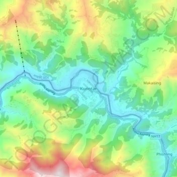
Name: Kurintar topographic map, elevation, terrain.
Location: Kurintar, Ichchhakamana, चितवन, बाग्मती प्रदेश, Nepal (27.83243 84.58281 27.91243 84.66281)
Average elevation: 760 m
Minimum elevation: 238 m
Maximum elevation: 1,856 m
Thank you for supporting this site ❤️
Make a donation
Make a donation