
Taman Nasional Tanjung Puting topographic map
Interactive map
Click on the map to display elevation.
About this map
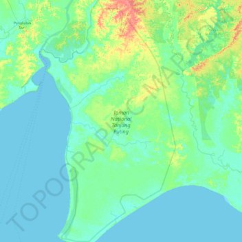
Name: Taman Nasional Tanjung Puting topographic map, elevation, terrain.
Location: Taman Nasional Tanjung Puting, Kalteng, Indonesië (-3.53153 111.70364 -2.58786 112.23302)
Average elevation: 8 m
Minimum elevation: -2 m
Maximum elevation: 52 m
Other topographic maps
Click on a map to view its topography, its elevation and its terrain.