
Thank you for supporting this site ❤️
Make a donation
Make a donation
Quinland topographic map
Click on the map to display elevation.
Thank you for supporting this site ❤️
Make a donation
Make a donation
About this map
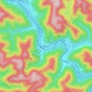
Name: Quinland topographic map, elevation, terrain.
Location: Quinland, Boone County, West Virginia, 25205, United States (37.99677 -81.79012 38.03677 -81.75012)
Average elevation: 376 m
Minimum elevation: 214 m
Maximum elevation: 561 m
Thank you for supporting this site ❤️
Make a donation
Make a donation
Other topographic maps
Click on a map to view its topography, its elevation and its terrain.