
Thank you for supporting this site ❤️
Make a donation
Make a donation
Chemin de Ceinture topographic map
Click on the map to display elevation.
Thank you for supporting this site ❤️
Make a donation
Make a donation
About this map
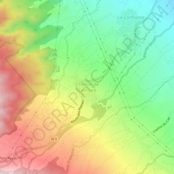
Name: Chemin de Ceinture topographic map, elevation, terrain.
Location: Chemin de Ceinture, Saint-Benoît, Réunion, 97437, France (-21.10155 55.67257 -21.06155 55.71257)
Average elevation: 288 m
Minimum elevation: 72 m
Maximum elevation: 554 m
Thank you for supporting this site ❤️
Make a donation
Make a donation