
Mrągowo County topographic map
Interactive map
Click on the map to display elevation.
About this map
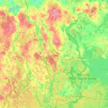
Name: Mrągowo County topographic map, elevation, terrain.
Location: Mrągowo County, Warmian-Masurian Voivodeship, Poland (53.62551 21.05137 53.99622 21.74382)
Average elevation: 141 m
Minimum elevation: 98 m
Maximum elevation: 214 m