
Thank you for supporting this site ❤️
Make a donation
Make a donation
Les Bugnenets topographic map
Click on the map to display elevation.
Thank you for supporting this site ❤️
Make a donation
Make a donation
About this map
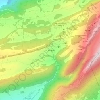
Name: Les Bugnenets topographic map, elevation, terrain.
Average elevation: 1,155 m
Minimum elevation: 805 m
Maximum elevation: 1,513 m
Thank you for supporting this site ❤️
Make a donation
Make a donation
Other topographic maps
Click on a map to view its topography, its elevation and its terrain.
Savagnier
Suisse > Neuchâtel > Val-de-Ruz
Savagnier se situe à environ 6 kilomètres à vol d'oiseau de la ville de Neuchâtel, sur le versant nord de Chaumont, dans la région et ancien district du Val-de-Ruz. Le Grand-Savagnier se trouve à une altitude de 770 mètres, le Petit-Savagnier à 737 mètres.
Average elevation: 863 m