
Biesme-sous-Thuin topographic map
Interactive map
Click on the map to display elevation.
About this map
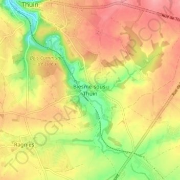
Name: Biesme-sous-Thuin topographic map, elevation, terrain.
Location: Biesme-sous-Thuin, Thuin, Hainaut, Wallonia, 6531, Belgium (50.30072 4.28799 50.34072 4.32799)
Average elevation: 171 m
Minimum elevation: 117 m
Maximum elevation: 211 m
Other topographic maps
Click on a map to view its topography, its elevation and its terrain.