
Thank you for supporting this site ❤️
Make a donation
Make a donation
Tannenheim topographic map
Click on the map to display elevation.
Thank you for supporting this site ❤️
Make a donation
Make a donation
About this map
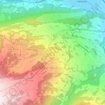
Name: Tannenheim topographic map, elevation, terrain.
Average elevation: 1,056 m
Minimum elevation: 424 m
Maximum elevation: 1,825 m
Thank you for supporting this site ❤️
Make a donation
Make a donation
Other topographic maps
Click on a map to view its topography, its elevation and its terrain.
Sargans
Schweiz > St. Gallen > Wahlkreis Sarganserland
Sargans liegt am Schnittpunkt des Alpenrheintals, das hier von Südosten nach Nordosten abbiegt, und dem Seeztal, das das Tal des Alpenrheins ohne nennenswerten Höhenunterschied mit dem Zürichsee verbindet.
Average elevation: 707 m