
乌拉斯台农场 topographic map
Interactive map
Click on the map to display elevation.
About this map
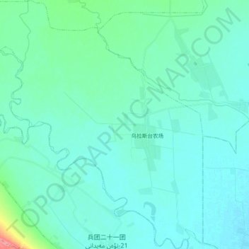
Name: 乌拉斯台农场 topographic map, elevation, terrain.
Location: 乌拉斯台农场, 和静县, 巴音郭楞蒙古自治州, 新疆维吾尔自治区, 中国 (42.14728 86.20566 42.27649 86.37507)
Average elevation: 1,078 m
Minimum elevation: 1,064 m
Maximum elevation: 1,172 m
Other topographic maps
Click on a map to view its topography, its elevation and its terrain.