
Thank you for supporting this site ❤️
Make a donation
Make a donation
Violet Hill topographic map
Click on the map to display elevation.
Thank you for supporting this site ❤️
Make a donation
Make a donation
About this map
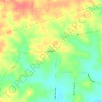
Name: Violet Hill topographic map, elevation, terrain.
Location: Violet Hill, Izard County, Arkansas, 72584, United States (36.13368 -91.86154 36.17368 -91.82154)
Average elevation: 232 m
Minimum elevation: 201 m
Maximum elevation: 264 m
Thank you for supporting this site ❤️
Make a donation
Make a donation
Other topographic maps
Click on a map to view its topography, its elevation and its terrain.