
Thank you for supporting this site ❤️
Make a donation
Make a donation
Pfeiffer topographic map
Click on the map to display elevation.
Thank you for supporting this site ❤️
Make a donation
Make a donation
About this map
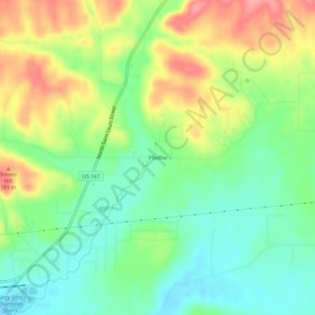
Name: Pfeiffer topographic map, elevation, terrain.
Location: Pfeiffer, Independence County, Arkansas, United States (35.80394 -91.60390 35.84394 -91.56390)
Average elevation: 138 m
Minimum elevation: 98 m
Maximum elevation: 198 m
Thank you for supporting this site ❤️
Make a donation
Make a donation
Other topographic maps
Click on a map to view its topography, its elevation and its terrain.
Southside
United States > Arkansas > Independence County
The elevation of Southside is 354 feet (108 m).
Average elevation: 112 m
Thank you for supporting this site ❤️
Make a donation
Make a donation