
汤山街道 topographic map
Interactive map
Click on the map to display elevation.
About this map
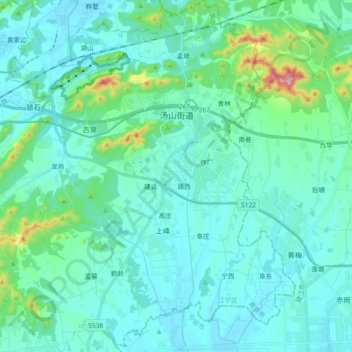
Name: 汤山街道 topographic map, elevation, terrain.
Location: 汤山街道, 江宁区, 南京市, 江苏省, 211131, 中国 (31.95496 118.94162 32.11090 119.11526)
Average elevation: 64 m
Minimum elevation: 10 m
Maximum elevation: 406 m
Other topographic maps
Click on a map to view its topography, its elevation and its terrain.