
Redcar topographic map
Click on the map to display elevation.
About this map
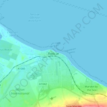
Name: Redcar topographic map, elevation, terrain.
Average elevation: 8 m
Minimum elevation: -2 m
Maximum elevation: 75 m
Other topographic maps
Click on a map to view its topography, its elevation and its terrain.
Malton
United Kingdom > England > North Yorkshire
As with the rest of the British Isles and Yorkshire, Malton possesses a maritime climate with cool summers and mild winters. The nearest Met Office weather station for which records are available is High Mowthorpe, about 6 miles (10 km) east of the town centre. Due to its lower elevation, the town centre is…
Average elevation: 28 m