
Thank you for supporting this site ❤️
Make a donation
Make a donation
Hickeytown topographic map
Click on the map to display elevation.
Thank you for supporting this site ❤️
Make a donation
Make a donation
About this map
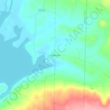
Name: Hickeytown topographic map, elevation, terrain.
Location: Hickeytown, Johnson County, Arkansas, United States (35.38481 -93.33073 35.42481 -93.29073)
Average elevation: 140 m
Minimum elevation: 102 m
Maximum elevation: 246 m
Thank you for supporting this site ❤️
Make a donation
Make a donation
Other topographic maps
Click on a map to view its topography, its elevation and its terrain.