
吊罗山乡 topographic map
Interactive map
Click on the map to display elevation.
About this map
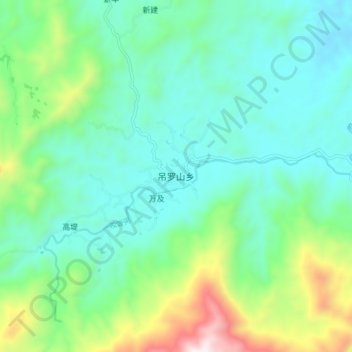
Name: 吊罗山乡 topographic map, elevation, terrain.
Location: 吊罗山乡, 琼中黎族苗族自治县, 海南省, 中国 (18.75465 109.83468 18.83465 109.91468)
Average elevation: 430 m
Minimum elevation: 196 m
Maximum elevation: 1,158 m
Other topographic maps
Click on a map to view its topography, its elevation and its terrain.