
Dexter topographic map
Interactive map
Click on the map to display elevation.
About this map
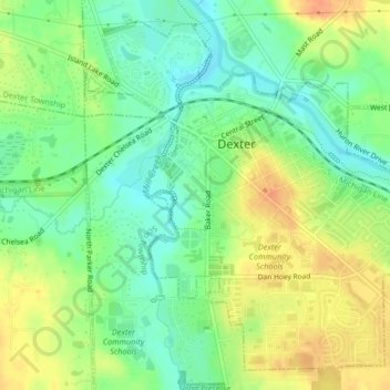
Name: Dexter topographic map, elevation, terrain.
Location: Dexter, Washtenaw County, Michigan, United States (42.31957 -83.90017 42.34699 -83.85887)
Average elevation: 270 m
Minimum elevation: 252 m
Maximum elevation: 290 m