
Thank you for supporting this site ❤️
Make a donation
Make a donation
Godog topographic map
Click on the map to display elevation.
Thank you for supporting this site ❤️
Make a donation
Make a donation
About this map
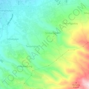
Name: Godog topographic map, elevation, terrain.
Location: Godog, Garut, West Java, Java, 44182, Indonesia (-7.25285 107.91570 -7.21285 107.95570)
Average elevation: 848 m
Minimum elevation: 709 m
Maximum elevation: 1,136 m
Thank you for supporting this site ❤️
Make a donation
Make a donation
Other topographic maps
Click on a map to view its topography, its elevation and its terrain.
Thank you for supporting this site ❤️
Make a donation
Make a donation
Thank you for supporting this site ❤️
Make a donation
Make a donation